Forecast maps shared with Newsweek by meteorologists illustrate how California and neighboring states are expected to be affected by several storms this week.
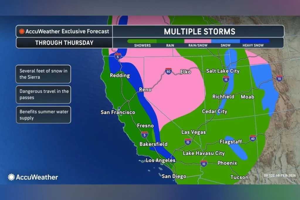
In a Monday advisory sent to Newsweek, AccuWeather said three storms are forecast to hit California through Thursday, delivering several inches of rain, the chance for severe thunderstorms, and "several feet" of snow to the Sierra Nevada.
In an email sent to Newsweek on Saturday, AccuWeather reported that the series of Pacific storms was expected to impact California, as well as the western U.S., beginning Sunday and continuing through mid-week.
"The pattern may deliver close to a month's worth of rain and snow in parts of California, increasing flood, mudslide and transportation risks," the email said.
According to AccuWeather, the first system will keep pushing inland on Monday. A second will move into California from Monday night through Tuesday night, with a third arriving Thursday and targeting the central coast and parts of Southern California. This pattern marks a shift after weeks of dry weather, above‑average temperatures, and declining statewide water levels for mid‑February, it noted.
"It will be a wet week across California as a series of storm systems slam into the state. Multiple inches of rain will fall across much of the state, with several feet of snow expected in the Sierra," said AccuWeather meteorologist Kai Kerkow.
"An abundance of cold air will result in snow levels dropping down to 4,000 feet by Monday evening. This week's pattern will bring significant travel impacts to the passes, including I-80 over Donner Pass.
"The state's snowpack is running well below average for this time of year due to a dry and warm weather pattern that lasted from the middle of January through the beginning of February, so the active weather pattern will be beneficial for the summer water supply."
The outlet said that rainfall totals of one to two inches are forecast for areas such as San Diego and the Central Valley, climbing to two to four inches around the Los Angeles Basin and into Northern California. West‑facing slopes exposed to upslope flow could see localized amounts exceed four inches, it said.
AccuWeather reported that there is potential for flash flooding, especially in urban neighborhoods and areas recovering from wildfires. Snow is forecast to reach elevations near 4,000 feet by Monday evening, and the Sierra may receive upwards of six feet by Thursday, with the most intense period stretching from Monday night to Tuesday. Drivers should expect intermittent closures of Sierra passes between Monday and Wednesday, including several stoppages at Donner Pass along Interstate 80, AccuWeather said.
On Monday, thunderstorms are likely to develop over the Los Angeles Basin, parts of coastal Southern California, and northern sections of the Central Valley, the outlet said. Hazards could include strong winds, downpours, frequent lightning and an isolated tornado. The area at risk spans major population centers from San Luis Obispo County to San Diego County, with additional tornado potential near the Sacramento Valley, according to AccuWeather.