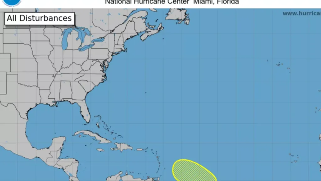
A new disturbance has formed in the central tropical Atlantic, the National Hurricane Center (NHC) in Miami reported on Sunday.
The system, known as a tropical wave, is located about 1,000 miles east-southeast of the Lesser Antilles in the Caribbean Sea. It's already producing disorganized showers and thunderstorms as it moves west-northwestward at approximately 10 to 15 miles per hour.
As of the NHC's latest forecast, environmental conditions appeared only marginally favorable for further development in the short term, with prospects falling to unlikely by midweek.
Newsweek has reached out to the NHC for further comment via email Sunday during non-working hours.
Why It Matters
While the current disturbance is expected to dissipate before posing a direct threat to land, tracking these systems gives meteorologists and emergency managers time to plan should conditions shift unexpectedly.
They are also valuable to residents and governments as they ready their emergency preparedness resources and emergency notification systems.
Storm preparedness and recovery has been of national concern following the floods in Texas that killed over 100 people and subsequent flash flooding across the U.S. amid funding cuts to the Federal Emergency Management Agency (FEMA).
What To Know
According to the NHC, the disturbance is identifiable as a tropical wave carrying clusters of disorganized showers and thunderstorms in the open Atlantic.
A tropical wave is defined by the NHC as "an inverted trough (an elongated area of relatively low pressure) or cyclonic curvature maximum moving east to west across the tropics."
These systems "can lead to the formation of a tropical cyclone. Also known as an easterly wave," the NHC cautions.
The system is being steered west-northwest by prevailing atmospheric conditions.
However, due to increasing wind shear and the potential intrusion of Saharan dust, the likelihood of the system organizing into a tropical depression or storm is currently considered low.
The forecast in the NHC's 7-Day Graphical Tropical Weather Outlook shows the wave track continuing over open water, with no watches or warnings currently in effect for any land areas.
The 2025 Atlantic hurricane season, which started June 1, has already seen three named storms: Andrea, Barry and Chantal.
What People Are Saying
Richard Pasch, senior hurricane specialist for the NHC, said in a statement Sunday: "Environmental conditions appear only marginally conducive for development during the next day or so while the system moves west-northwestward at 10 to 15 mph. By the middle of the week, environmental conditions are forecast to become unfavorable for further development."
NHC Deputy Director Jamie Rhome told The Daytona Beach News Journal: "If a system is near land and there is potential for development, the National Hurricane Center won't wait before it issues advisories, even if the system hasn't become an actual storm. This gives residents time to prepare."
What Happens Next?
The NHC and partnering meteorological agencies will continue to monitor the progress of this tropical wave.
Updates and outlooks are issued several times daily on the NHC's official website.