Two more icy cold fronts are expected to sweep across Australia in coming days, as experts warn the worst of the freezing conditions is far from over.
Millions of Aussies have suffered back-to-back cold fronts this week, the first battering Western Australia before sweeping the south-east, and the second bringing wet and wild weather making to millions to Victoria.
While the southeast is expecting a return to milder conditions over the weekend, the next cold front to strike the region is expected early next week, while WA will likely be hit with a separate front as soon as Saturday.
Dean Narramore, a senior meteorologist at the Bureau of Meteorology, said the first cold blast will strike south-western WA before moving east from Sunday night.
He said Perth should expect showers and gusty winds from Saturday with about 10-20mm of rain and isolated, higher falls further south before sweeping east.
'Then that front will impact down around Adelaide and southern South Australia on Sunday, where they'll see a burst of showers and gusty winds on Sunday,' he said.
As it sweeps east, a second cold blast is expected to make landfall on the country's south-east, bringing a torrent of cold, wet and windy conditions.
'Places like Hobart, Melbourne and Canberra in the country's southeast should expect those showers and gusts,' Mr Narramore said.
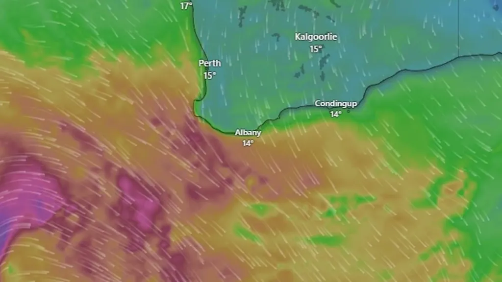
A cold front is set to make landfall over Western Australia on Saturday (pictured in red)
Wet, windy weather is expected to persist as two cold fronts make landfall in coming days (pictured, a pair of walkers shield themselves from the wet weather in Perth)
'That will bring in some cold air and we'll once again see cold, wet and windy conditions for the south east.'
Mr Narramore said the conveyor belt of cold fronts is part of a 'pattern' involving the regular arrival of back-to-back, sweeping cold systems.
'Regular cold fronts every few days across southern parts of the country are becoming pretty common,' he said.
'Each time they sweep across here, they bring a burst of rain showers, you know, isolated thunderstorms, gusty winds, and alpine snow.'
The cold fronts are expected to deliver a fresh polar blast to hit alpine regions in the country's south-east as soon as Monday.
'There's the potential for yet another outbreak of polar air with more wind, rain and snow at higher elevations across southeastern Australia to start off next week,' Weatherzone advised.
In separate forecasts, the Bureau has cancelled a severe weather warning including damaging winds for NSW's south coast expected to hit this weekend.
Meanwhile, marine wind warnings to all Australian states and territories remain in place and are expected to persist into Saturday night.
Several Aussie states have recorded record low minimum temperatures this June
It comes after Aussies shivered through a series of cold blasts this week.
The first gusts and high rain hit WA on Monday, before delivering strong winds and rainfall to parts of South Australia as it moved to the south-east.
The second front rolled across the Bight bringing a chill to the SA capital followed by heavy snowfall to the alpine resorts of NSW and Victoria.
Light showers and frigid westerly winds lashed Melbourne early on Thursday before conditions began to moderate across the south-east into Friday morning.
Aussies expecting a warmer winter than usual received a rude shock, as several states experienced their coldest start to the winter season in years.
In June, NSW shivered through its lowest minimum temperature since 2006 while Queensland and the Northern Territory recorded the lowest averages since 2012.
Weather Forecast
| City | Saturday | Sunday | Monday |
|---|---|---|---|
| Sydney | Mostly sunny. Min 10 Max 19 | Mostly sunny. Min 7 Max 20 | Partly cloudy. Min 11 Max 19 |
| Melbourne | Possible shower. Min 7 Max 17 | Showers. Min 10 Max 16 | Shower or two. Min 7 Max 13 |
| Brisbane | Sunny. Min 9 Max 22 | Sunny. Min 9 Max 22 | Sunny. Min 10 Max 23 |
| Perth | Showers. Min 11 Max 19 | Partly cloudy. Min 7 Max 17 | Partly cloudy. Min 7 Max 18 |
| Adelaide | Mostly sunny. Min 9 Max 18 | Showers. Min 11 Max 17 | Showers. Min 9 Max 13 |
| Hobart | Partly cloudy. Min 4 Max 13 | Showers. Min 8 Max 16 | Shower or two. Min 5 Max 10 |
| Canberra | Morning frost. Cloud clearing. Min 0 Max 14 | Morning frost. Possible shower. Min -3 Max 13 | Shower or two. Min 1 Max 12 |
| Darwin | Mostly sunny. Min 21 Max 32 | Mostly sunny. Min 22 Max 31 | Mostly sunny. Min 21 Max 32 |