A powerful winter storm that may turn into a "super bomb" threatens New York City and the Northeast with heavy, wet snow by the foot starting Sunday and tropical storm-strength wind gusts that are likely to drop power lines, ground planes and make travel life-threatening.
A blizzard warning stretches from New Haven, Connecticut, south to Delaware, including New York and Long Island starting 6 a.m. Sunday. It's likely to be extended into southern New England and Boston.
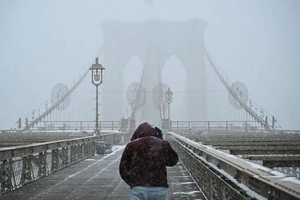
As much as 15 inches (38 centimeters) may fall in Manhattan.
The storm is forecast to strengthen so quickly Sunday -- with its central pressure dropping 24 millibars in 12 hours -- that staff at the US Weather Prediction Center are calling it "a super bomb," said Brian Hurley, a senior branch forecaster at the agency.
"It is a true nor'easter," Hurley said. "It is going to stay awhile, too. It is going to hang around for much of Monday. The highest amounts are projected for central and eastern Long Island and coastal New Jersey where there is 20 inches in the forecast."
Central pressure is a measure of strength and when a storm drops that much in 24 hours it undergoes what's called bombogenesis.
Travel Disruption
With temperatures near freezing, the snow will be wet and heavy. Combined with winds gusting as high as 55 miles (88 kilometers) per hour, it's almost certain to topple power lines and trees, causing outages.
Sunday flight cancellations are certain to rise, especially in the busy New York City area, causing a cascade of disruptive travel trouble at the start of the work week.
Ground travel will be dangerous, and the Weather Service warns anyone venturing out to take a survival kit with them.
Amtrak said in an X post Friday that "service adjustments may be necessary" along its Northeast Corridor routes.
While the forecast isn't as certain for Washington, DC, and points south, "I feel really good about east central New Jersey up to Long Island and I feel good about New York City as well," Hurley said.
The worst of the snow will be along coastal areas, which can lead to forecast glitches if there's a jolt in the storm track. While that happened a few years ago when New York ended up with far less than a forecasted several feet of snow, Hurley said he isn't counting on it this time.
Snow will start falling in New York late Sunday morning and build with intensity, but "it doesn't really start cranking until the late afternoon and overnight," Hurley said. "Most of the heaviest is going to be between midnight and 6 a.m."
In Boston, the worst of the storm will likely arrive about 6 a.m. Monday.