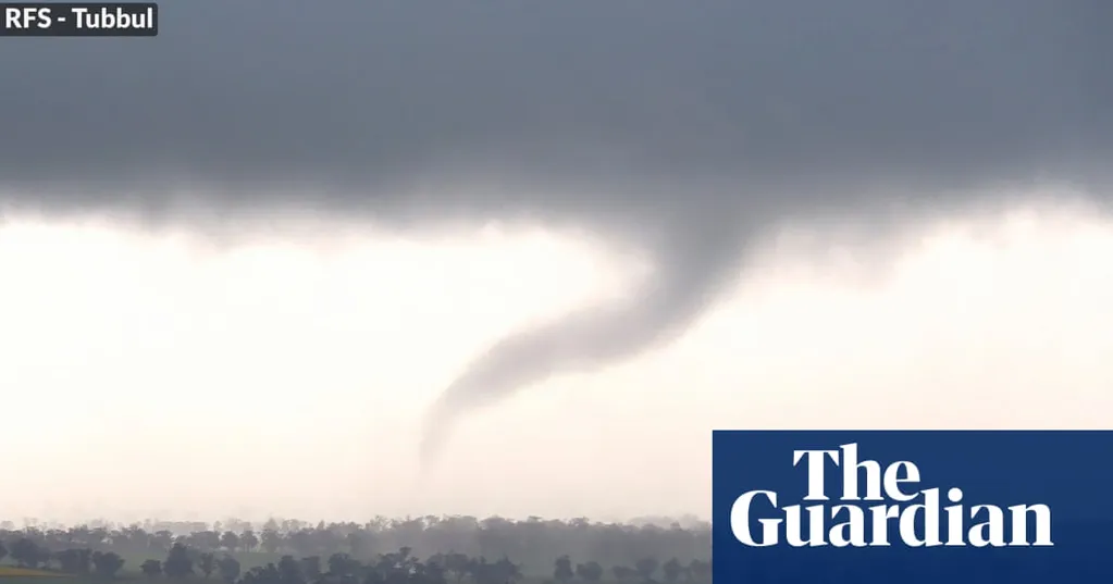
Two groups have been rescued from flooding and while a tornado warning for central New South Wales has been downgraded as large parts of the state brace for a further battering of rainfall and heavy winds from a low pressure system off the Tasman Sea.
The NSW State Emergency Service said it had responded to more than 90 incidents in the past 24 hours, including flood rescues for a motorist who had driven off a cliff face at Camden Bypass and a group of bushwalkers trapped by floodwaters at Wattamolla.
Communities on the Illawarra and South Coast, including Wollongong, Goulburn, Nowra and Bowral have been urged to brace for six hourly rainfall totals of up to 100mm and damaging winds as the low-pressure system moves across the state, causing flash flooding and minor riverine rises.
Around 3.30pm, a tornado was observed north west of Young amid the wild weather, the Bureau of Meteorology confirmed, prompting a warning that was later cancelled.
Further north, a dynamic weather system could hit parts of Queensland in the coming days after the region of Birdsville was hit with wind gusts in excess of 110 km/h and 467,000 lightning strikes on Monday.
NSW SES state duty commander, assistant commissioner Dean Storey, said flash flooding could occur "quickly and without warning".
"We implore motorists to never drive, walk or ride through floodwaters," he said.
Severe thunderstorms and possible flash flooding were also expected to develop on Wednesday evening across large parts of the state, including the Hunter and Central Tablelands, before easing as the system moved over the Tasman sea on Thursday.
Destructive wind gusts of up to 125 km/h were possible, and large hail of 2-4cm.
Senior meteorologist at the BoM, Miriam Bradbury, said large parts of eastern NSW had been hit with a significant amount of lightning, rain and showers in the past 24 hours, with further severe thunderstorms on the way.
"We're going to see a low pressure system moving off the coast and starting to pull significant moisture and winds ... that is going to produce an acute risk of severe weather from later tonight, continuing ... into the early hours of tomorrow morning,"
she said.
Five minor flood warnings were in place in the Darling, Macquarie, Bogan, Orange, Upper Hunter, Hawkesbury Nepean Valley and St Georges Basin catchments, which could lead to local road and bridge closures, the NSW SES said.
A hazardous surf and strong wind warning was also active for large parts of the coastline, including Sydney.
Senior meteorologist at the BoM, Dean Narramore, said windy and showery conditions would remain along the cost on Thursday but inland parts of NSW could start drying out after a "wet, wet, wet day".
He said Sydney was forecast to hit 18 degrees on Thursday, with rainfall continuing, while inland areas and coastal regions would also hit high teens.
