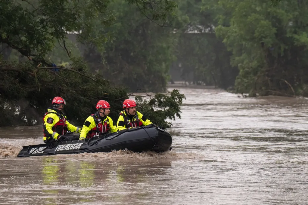
Much of central Texas remains under a flood watch, with some areas facing life-threatening flash floods as torrential rains hammer the Lone Star State on Thursday.
National Weather Service (NWS) meteorologists began warning of the moisture-laden storm earlier in the week. Upper end forecast totals anticipated as much as 6 inches of rain hitting some areas, a very "concerning" amount, NWS lead meteorologist Emily Heller told Newsweek, as many of the cities within the warning area only see around 1 inch of rain throughout the entire month of November.
NWS meteorologists began issuing flash flood warnings on Wednesday night. The warnings increased in urgency on Thursday afternoon when the NWS office in San Angelo declared a flash flood emergency for Menard, Texas.
"This is a FLASH FLOOD EMERGENCY for Menard. This is a PARTICULARLY DANGEROUS SITUATION. SEEK HIGHER GROUND NOW!" the flash flood warning stressed. "Move to higher ground now! This is an extremely dangerous and life-threatening situation. Do not attempt to travel unless you are fleeing an area subject to flooding or under an evacuation order."
Heavy rain is expected to continue battering the area through at least Thursday night.
Animated weather footage from windy.com revealed thunderstorms trekking across Texas, many of them embedded with moisture that is creating the life-threatening flood risk.
Several inches of rain have already fallen across Texas, with more than 6 inches possible in some locations, according to a flood watch from the NWS. Over the next three days, some parts of Texas are anticipating an additional 3 inches of rainfall, according to windy.com.
A slew of severe weather warnings are in place across central Texas.
These include flash flood warnings, flood warnings, flood advisories, flood watches, and a hazardous weather outlook.
NWS San Angelo in a post on X: "West Texas Mesonet gage at Menard now over 8.5 inches, adding 2 inches in the last hour. Other gauges in Menard over 6 inches, with radar estimates over 9 inches. Dangerous flooding conditions likely developing around Menard. Do not attempt to cross flooded areas!"
NOAA Satellites posted on X: "Water Vapor imagery from @NOAA's #GOESEast (#GOES19) helps show the moisture streaming into Texas this morning. Parts of central/ northern Texas are under a #Flood Watch through tonight, as showers and thunderstorms tap into the moisture and dump heavy rain in locations."
Most flood watches will remain in effect through late Thursday night, although it can take time for water levels to recede after a major flood event. People are urged never to drive through flooded roadways, as most flood deaths occur in a vehicle.